A RapidRide line is coming to Auburn, Kent, and Renton in 2023 to provide more than just a more frequent and faster bus. King County Metro also is planning new station standards at stops and making lasting improvements to streets. In the latest project update, Metro unveiled four types of stations standards depending upon expected ridership and station access needs dictating improvements to be rolled out.
New station standards
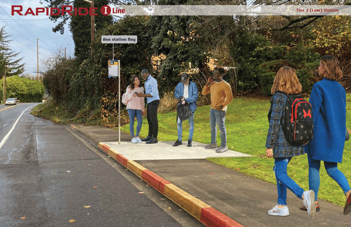

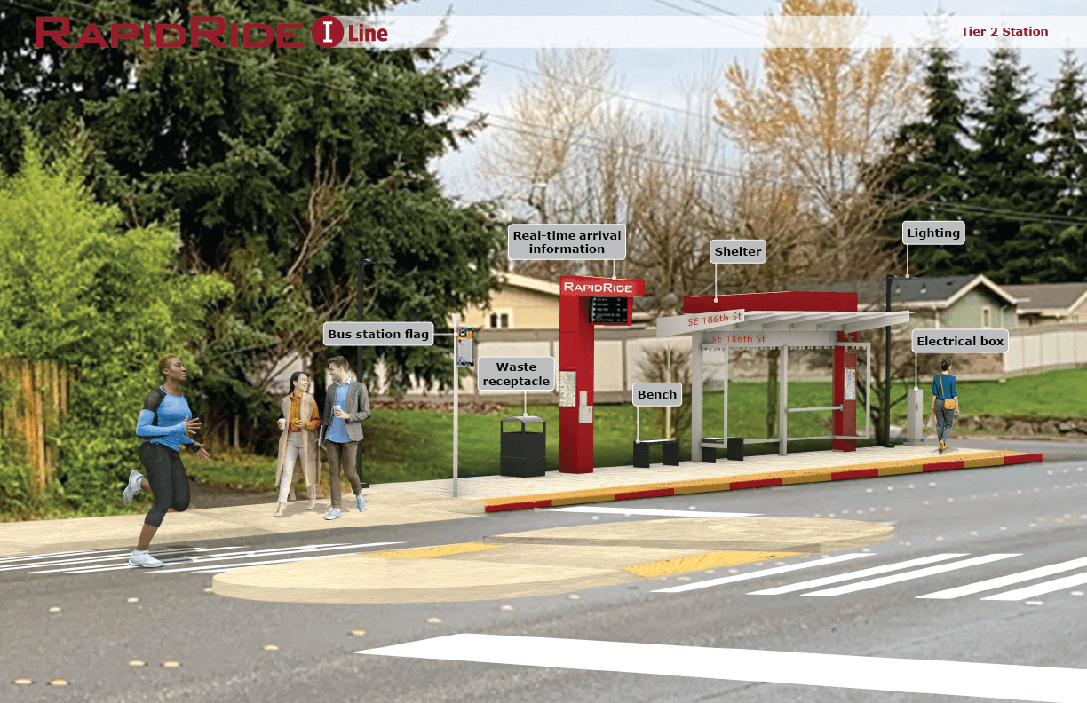
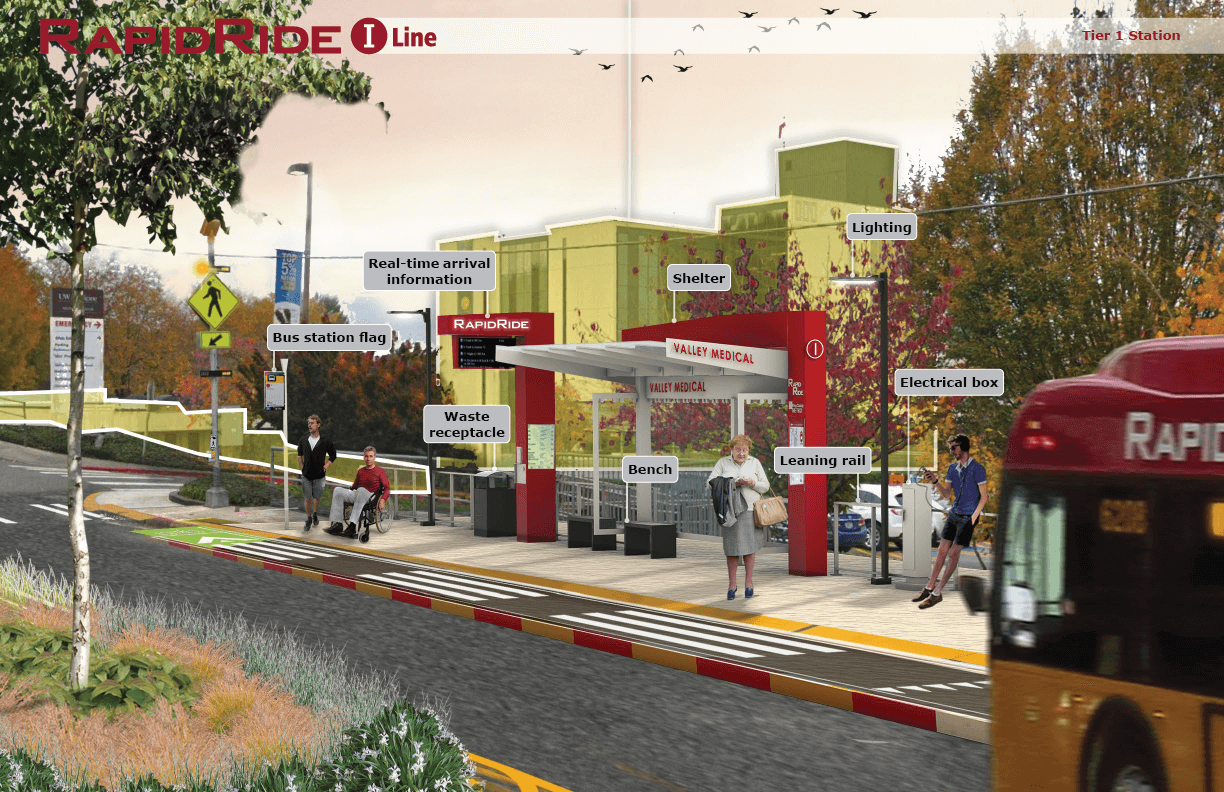
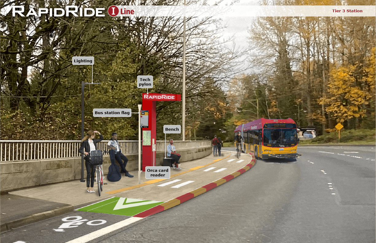
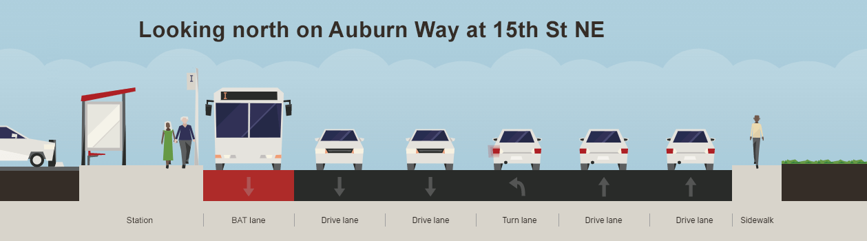
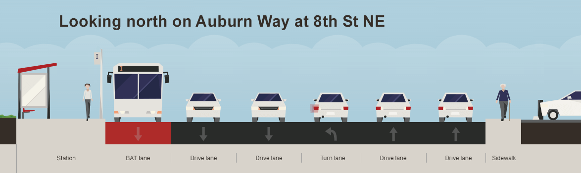
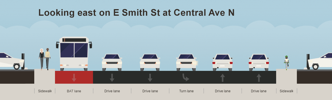
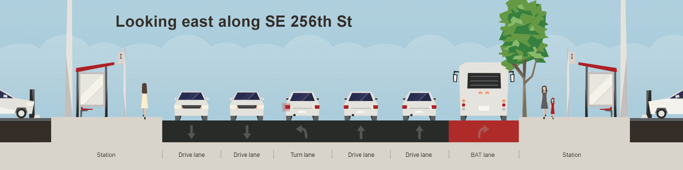
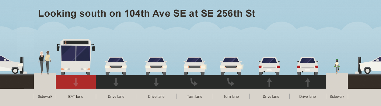
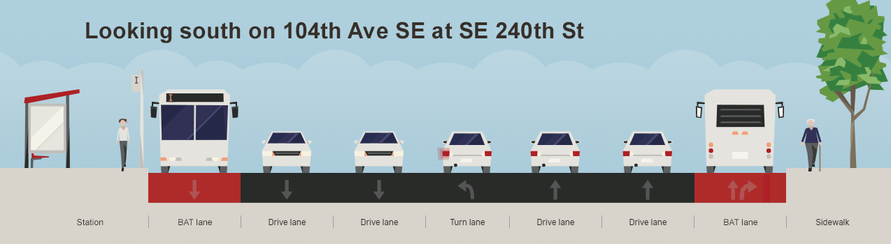
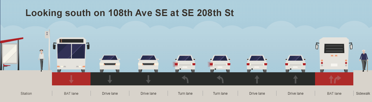
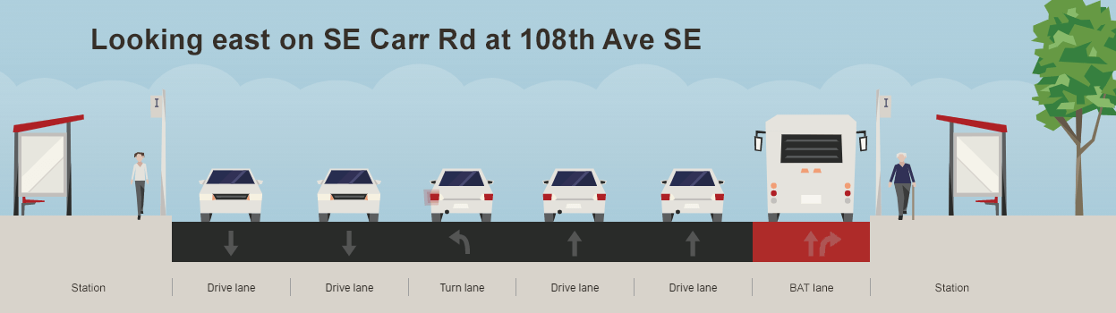
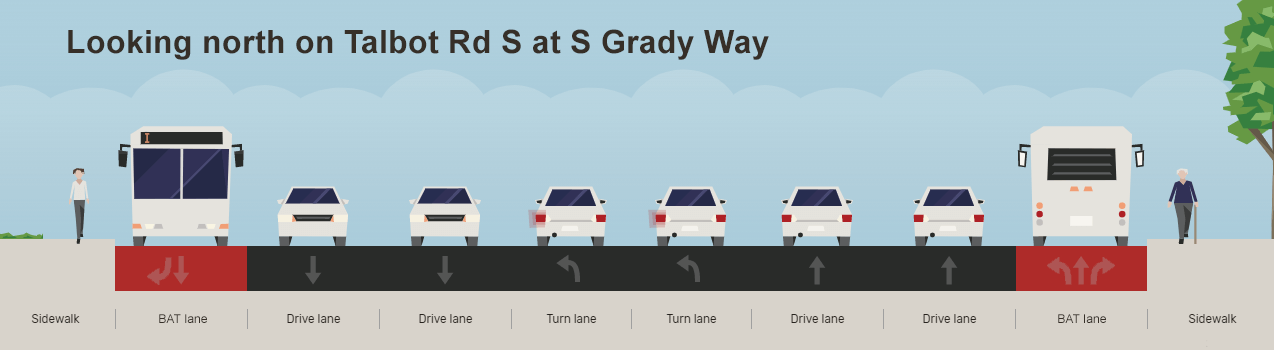
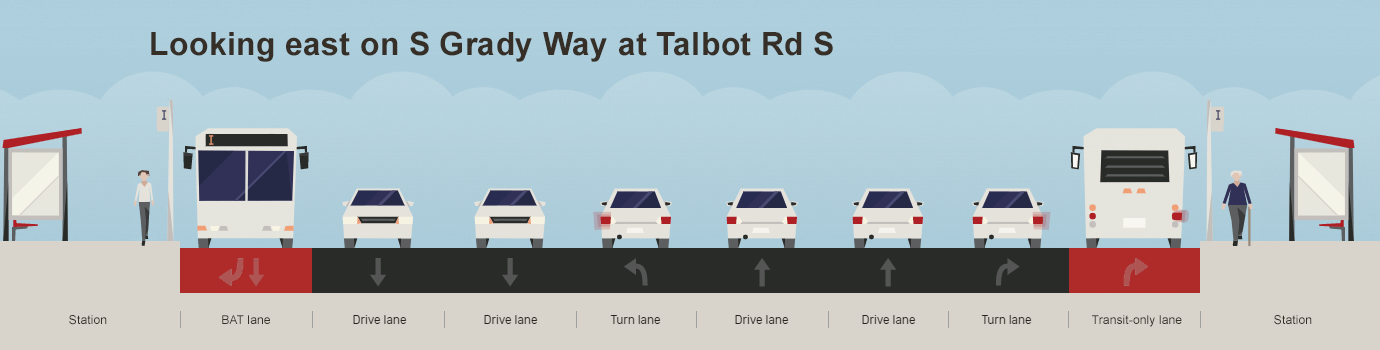
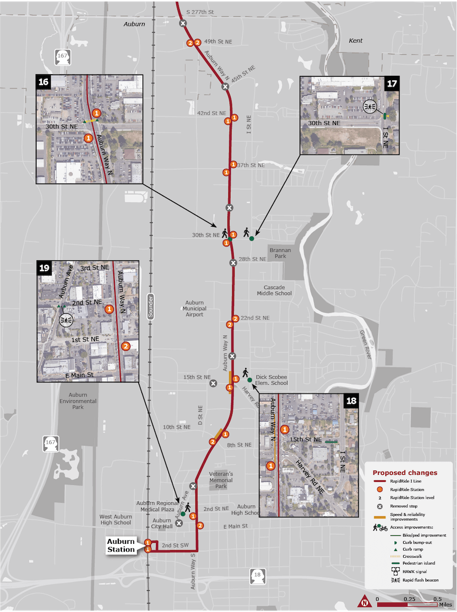
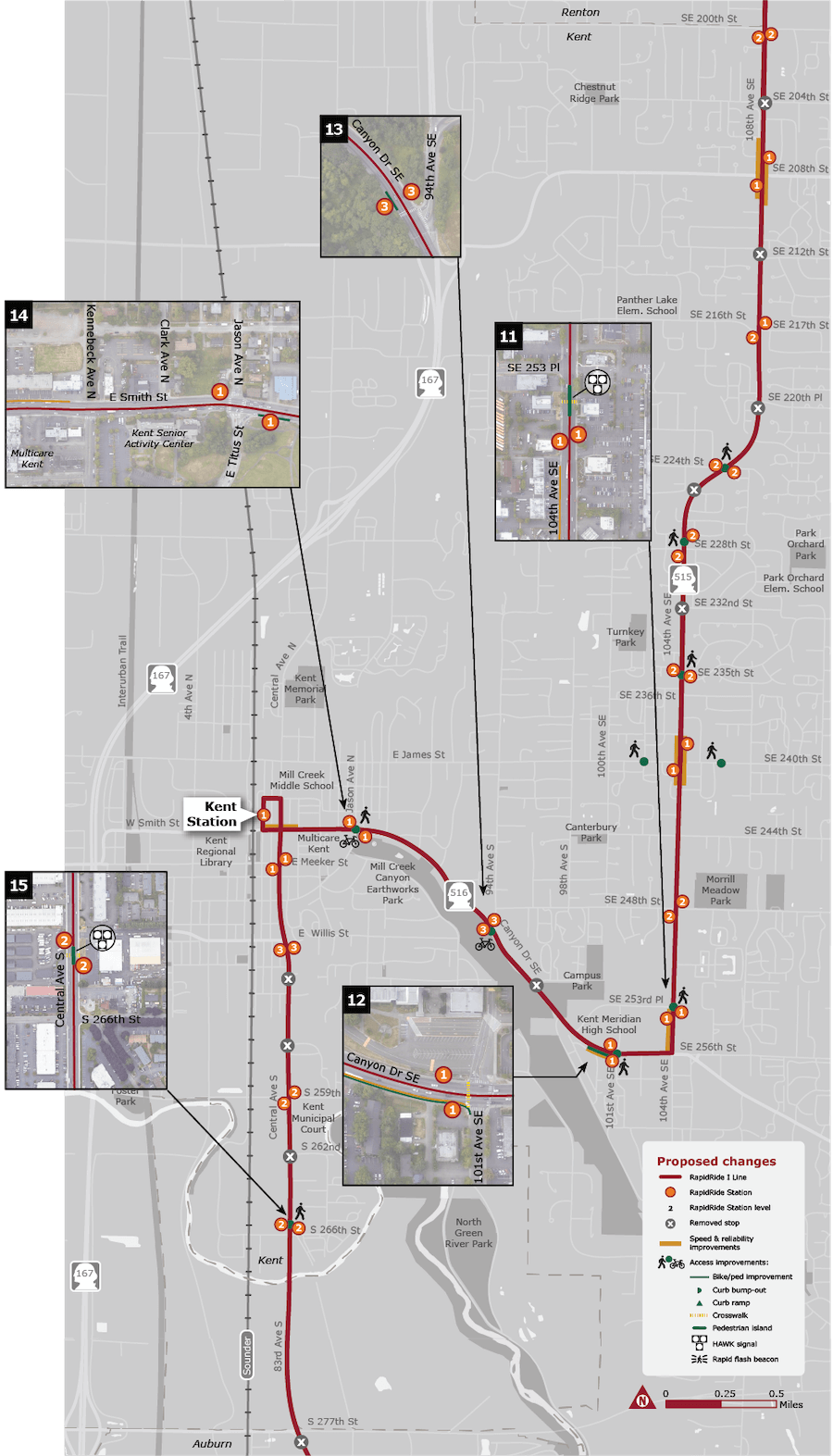
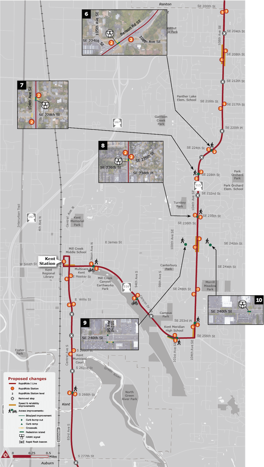
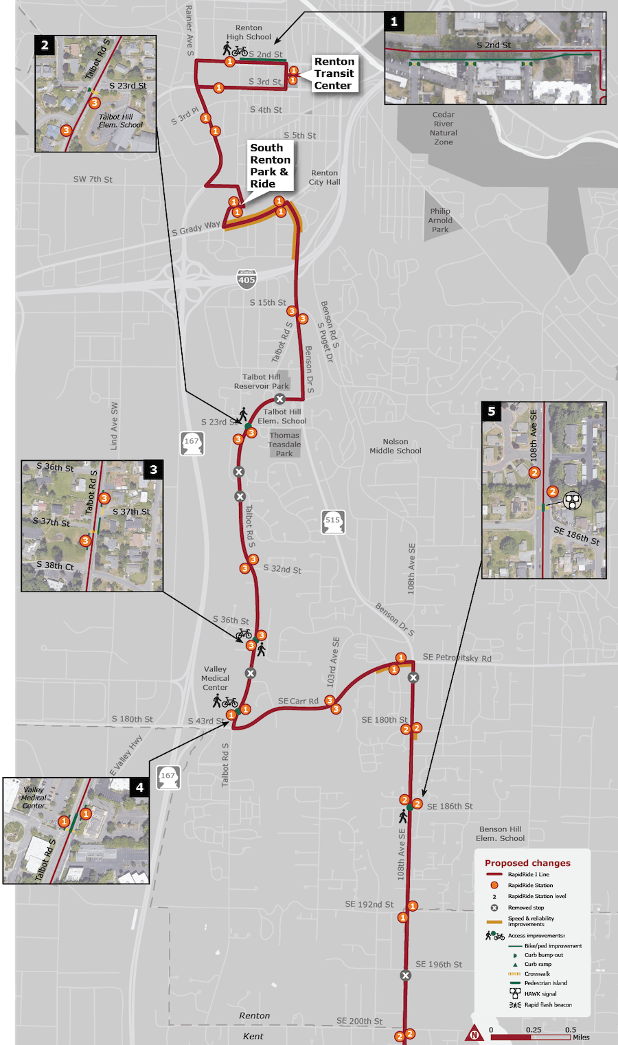
Metro’s RapidRide program has long had its own station design standards, but the RapidRide I Line will feature a completely new look and feel from past iterations. The agency has released four general versions of stations based upon expected ridership of stops, which include:Tier 1 stations with 150 to 349 riders per day;Tier 2 stations with 50 to 149 riders per day; andTier 3 and Tier 3 Low stations with 49 or fewer riders per day.Tiers 1, 2, and 3 will all have ORCA card readers, lighting, and benches, but Tiers 1 and 2 will also come with transit shelters, waste bins, and real-time arrival signs. Tier 3 Low will be the most basic station design with only a bus stop flag and bus loading pad.For branding, the Tier 1, 2, and 3 stations will appear the traditional RapidRide red and feature blocky pylons with attached ORCA card readers, maps, and real-time arrival signs where available. Transit shelters will have a similar blocky theme and feature the station stop name on canopy blades.Improvements by communityMetro has already predetermined which station stops along the corridor will be Tier 1, 2, and 3. Most stations will fall into Tiers 1 and 2. In tandem with these stations, the agency is planning to provide better access to them through street improvements. Metro has identified 19 different station access projects along the RapidRide I Line corridor that could be implemented. Many of these are new pedestrian crossings near stations.In Renton, these include the following (see maps for corresponding numbers and location):#1 – On S 2nd St, a two-way bike lane is planned from Shattuck Ave S to Logan Ave S near the high school as well as new intersection curb bulbs;#2 -On Talbot Rd S at S 23rd St, curbs will be bumped out for the crossing in front of Talbot Hill Elementary School;#3 – On Talbot Rd S at S 37th St, a crosswalk and raised bike lane through the new stations will be added;#4 – On Talbot Rd S at S Carr Rd, a pedestrian refuge island is proposed along with raised bike lanes through the new stations; and#5 – On 108th Ave SE at SE 186th St, a special beacon and crossing system called a High-Intensity Activated Crosswalk (HAWK) and pedestrian refuge island are planned.In Kent, these include the following (see maps for corresponding numbers and location):#6, #7, #8, and #11 – On Benson Rd SE and 104th Ave SE at SE 224th St, SE 228th St, SE 235th St, and SE 253rd St, additional HAWK crossings and beacons and pedestrian refuge islands are planned;#9 – On 102nd Ave SE at SE 240th St, a new marked crosswalk, curb bump out, and pedestrian light phase are planned near the Fred Meyer entrance;#10 – On SE 240th St just east of 104th Ave SE, a midblock HAWK crossing and beacon as well as a pedestrian refuge island are planned;#12 – On SE 256th St at 101st Ave SE near Kent-Meridian High School, Metro is planning a new marked crosswalk and pedestrian signal at the stoplight on the western side of the intersection and sidewalk improvements on the southside of Canyon Dr;#13 – On Canyon Dr at 94th Ave S, a raised bike lane through the new stations will be added;#14 – On E Smith St at E Titus St, a raised bike lane through the new stations will be added along with an accessible connection to Mill Creek Canyon Earthworks Park; and#15 – On Central Ave S north of S 266th St, a midblock HAWK crossing and beacon as well as a pedestrian refuge island are planned.In Auburn, these include the following (see maps for corresponding numbers and location):#16 – On Auburn Way N at 30th St NE, a new crosswalk, curb ramps, and two pedestrian signals are planned on north side of the intersection;#17 – On I St NE at 30th St NE, new rapid-flashing beacons for pedestrians are planned on the north side of the intersection;#18 – On 15th St NE at I St NE, missing sidewalks will be constructed to provide access to Dick Scobee Elementary School; and#19 – On Auburn Ave at 2nd St NE, new rapid-flashing beacons for pedestrians are planned on the north side of the intersection.As far as right-of-way rechannelizations go, Metro is proposing modifications in all three cities to prioritize bus movements (see maps for gold lines and location) that largely involve some targeted roadway widening and installation of business access and transit (BAT) lanes:On S Grady Way near the South Renton Park & Ride and Talbot Rd S north of I-405, and the roadway will be widened by one lane and provide a BAT lane in each direction, except on S Grady Way an eastbound lane will be a transit-only lane instead of a BAT lane;On a short stretch SE Carr Rd near the intersection of 108th Ave SE, Metro is planning to widen the roadway to provide a BAT lane in the eastbound direction;On 108th Ave SE near the SE 208th St intersection, a lane in each direction is planned to be converted to BAT lanes;On 104th Ave SE near the SE 240th St intersection, Metro plans to widen the roadway to provide a BAT lane in both directions;On 104th Ave SE near the SE 256th St intersection, the roadway will be widened to provide a BAT lane in the southbound direction;On SE 256th St near the 101st Ave SE intersection, there will be signal improvements and the roadway will be widened to provide an eastbound BAT lane;On E Smith St between N Kennebeck Ave and Railroad Ave, Metro will widen the roadway to provide a westbound BAT lane; andOn Auburn Way near the 15th St SE and 8th St SE intersections, a southbound lane will be converted to a BAT lane and the roadway will be widened by one lane.Overall, the improvements planned for the RapidRide I Line are expected to reduce travel times up to 20%, which should be a welcome change for riders. But the plans do involve a lot of expensive and unnecessary road widening rather than conversion of existing lanes for bus priority. Bike lane improvements at stations may also have mixed, conflicting results where they overlap with boarding areas rather than being routed behind stations next to the sidewalk. Nevertheless, final design of the project should wrap up in the fall and construction is planned to begin in 2022.
RapidRide I staying on schedule makes it unique among Metro’s expansion plans. Facing budget constraints, Metro has delayed other planned RapidRides like the RapidRide R upgrading Route 7 in the Rainier Valley and the RapidRide K in Kirkland. Moreover, the Seattle Department of Transportation and Metro agreed to cut in half the RapidRide J (upgrading Route 70) and shelve RapidRide plans for Route 40, Route 44, and Route 48 in Seattle to stretch a thin budget. Likewise, the RapidRide G has faced a series of delays and snags, pushing it back from an initial hoped-for opening of 2019 to fall 2024. However, the agency is prioritizing completion of RapidRide I, citing its equity framework and high transit-dependent population in the corridor.
Metro Unveils More RapidRide I Line and New Bus Base Concepts, Wants Feedback