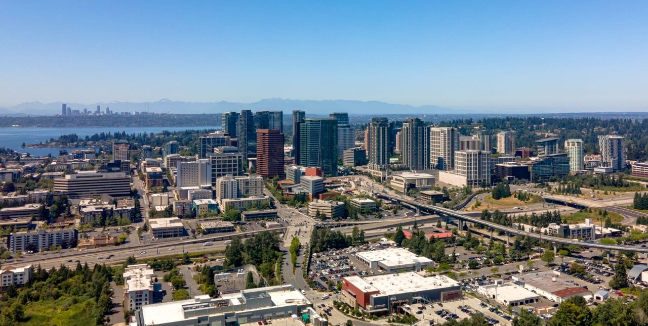
A new freeway interchange is likely on the way south of Downtown Bellevue. The City of Bellevue is partnering with the Washington State Department of Transportation (WSDOT) to evaluate improved I-405 access in south downtown, roughly defined as south of NE 4th Street and between 112th Avenue SE and 116th Avenue SE.
A new “half interchange” was included in the current I-405 Master Plan in 2002, and Bellevue is now seeking a preferred alternative to provide certainty for property owners along both sides of I-405, to support transit-oriented development around both East Main and Wilburton future East Link stations.
It is early enough in the process that a new or expanded interchange is not a fait accompli, so while I-405 will presumably not go away, we can work to reduce its impact on one of our most important urban centers outside of Seattle.
The study is constrained by the explicit goal of reducing congestion, but there is enough here for urbanists to be optimistic. Naturally, concerns of induced demand abound whenever a new interchange is introduced, but the study is clear that the goal is improved access to I-405, not necessarily more access to I-405. It should be possible to improve the circulation of vehicles on and off I-405 in a way that improves safety and resiliency for vehicles while also improving bike and pedestrian mobility. This study may achieve that balance by proposing new I-405 access points while also rebuilding some of the natural street grid.
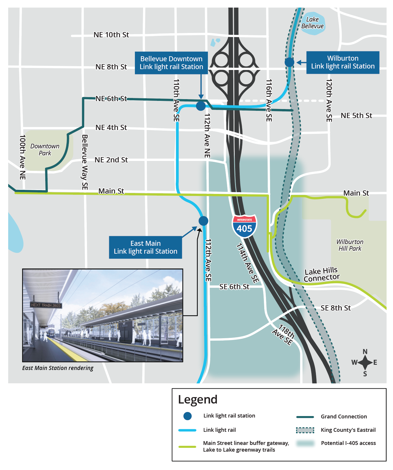
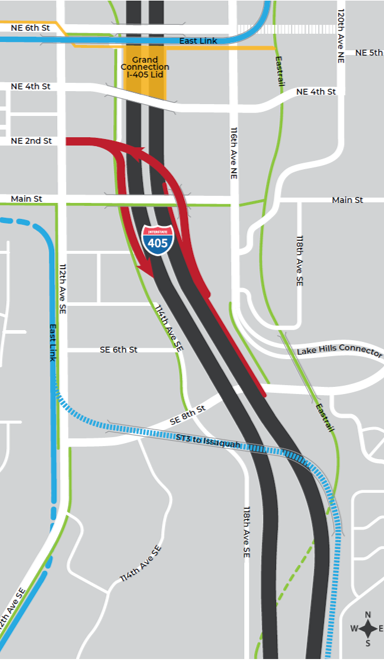
Additionally, it is important to evaluate further investment in I-405 in the context of Bellevue’s Grand Connection. One of the primary goals of the Grand Connection is to stitch together Downtown Bellevue and create a continuous urban space from Lake Washington to Eastrail and onwards to Redmond. In a recent post on the The Urbanist, Hyra Zhang highlighted the expansive footprint of the NE 8th Street interchange and how it could be reduced via the Grand Connection Lid, arguing for the relocation of existing ramps to reprioritize precious downtown urban space in Bellevue.
This study should have the same goal of improving mobility within Bellevue, not simply improved access in and out of Bellevue. Thankfully, options 2 through 6 appears to do well in increasing east-west mobility while having no or minimal expansion of the freeway envelope. While the NE 8th is outside of the study area, public feedback could encourage decision makers to be more bold and consider reducing the impact of the existing NE 8th interchange alongside improving I-405 access south of NE 4th.
Option 1 is the original car-centric vision included in the 2002 master plan and doesn’t offer anything for those walking or rolling and does nothing to bridge the I-405 divide.
Option 2 removes an existing left-hand turn access point on 4th Street SE, replacing it with a right-hand exit off Lake Hills Connector. Not only is a right-hand exit generally safer for both cars and pedestrians, this option may pull the traffic queuing onto I-405 away from the urban core.
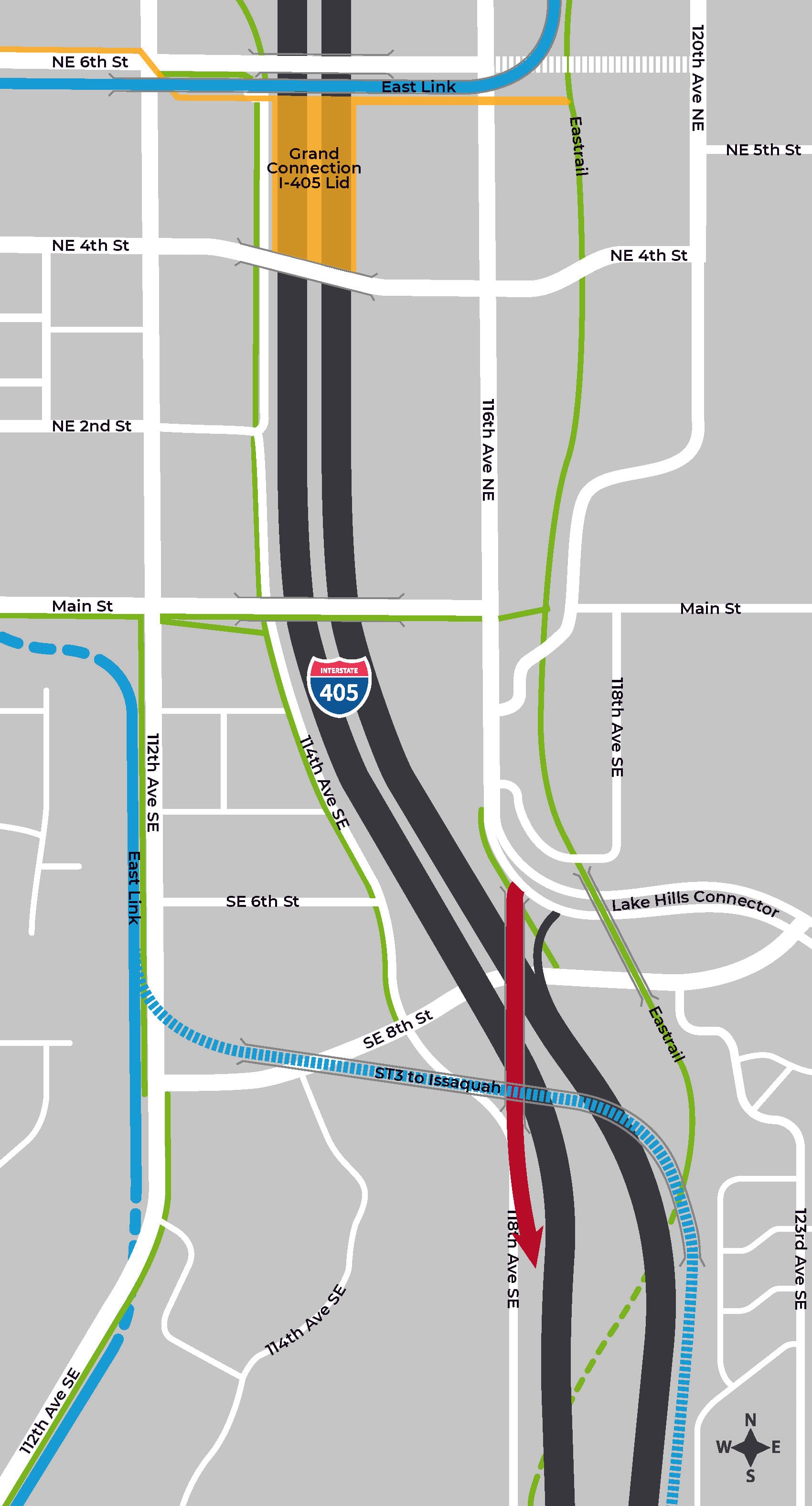
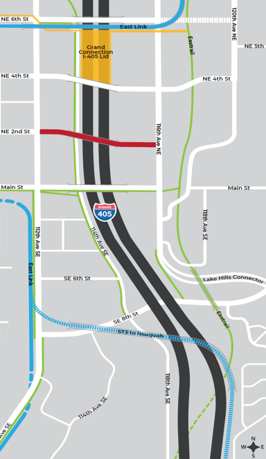
Option 3 provides no new ramps at all. Creating another crossing of I-405 at NE 2nd Street provides many of the same walking and rolling mobility benefits as the Grand Connection will a few blocks further north, albeit without the new public space or reduction in noise pollution of a proper lid. More specificity on how a new bridge would improve walking and biking facilities, not just vehicle circulation, which would be helpful.
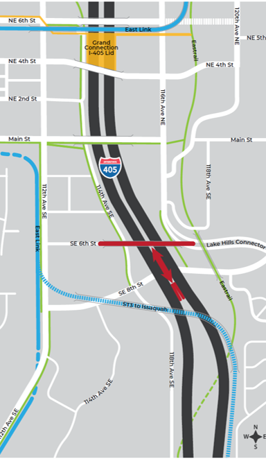
Options 5 and 6 create a new crossing at SE 6th Street. While perhaps too far from Downtown Bellevue to be as useful as Options 2 and 3, continuing to rebuild the street grid punctured by I-405 is good outcome. However, these options may have negative impacts on the emerging East Main TOD district.
And finally, there is a no build option. If the above options do not meaningfully improve walking, biking, or transit mobility within Bellevue, we are better off sticking with the existing infrastructure in the medium term.
I encourage you all the weigh in on the survey which is open through August 21st.
The featured image is a Creative Commons photo by CommunistSquared.